Varayattumotta Trek
Important Note: This article is a summary of my experience in 2016. Current details of the event/location may be different from what is mentioned in the article.
Introduction
Varayattumotta Trek
Varayattumotta is a mountain ridge located about 40km from Trivandrum city. It is famous for its small population of Nilgiri Tahr which is an endangered species. In Malayalam, Nilgiri Tahr is known as Varayaadu and the name of the mountain ridge is derived from it. Varayattumotta in all its glory is visible from the Ponmudi mountain, a very popular destination in Trivandrum accessible by car. Kerala forest department allows trekking to this location as part of its eco-tourism activities.
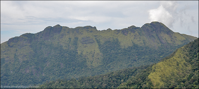
This mountain range also known in various other names such as Varayadumotta, Varayadumudi and Varayattumudi. I have also heard stories that Varayattumotta was originally known as Ponmudi.
Varayattumotta with a peak height of around 1100m is accessible after a trek from Ponmudi check post or from Mankayam check post along the Braemore route. The mountain ridge is very steep except on the northern side and hence is rarely visited by local people. The ridge is a protected site under the Palode reserve forest and prior permission is required for the trekking. The permission can be obtained from the ecotourism units of Mankayam or Ponmudi by paying a fee for the trekking team. A forest guide will accompany the trekking team. Usually trekkers climb the mountain and return to either Mankayam or Ponmudi. It is also possible to cross the entire ridge and reach the Kallar valley along the Ponmudi main road. However this is a much tougher trek trail.
Getting To Varayattumotta
There are 2 main trek routes to reach Varayattumotta. One is from Mankayam check post on the way to Braemore estate. The second route is from Ponmudi check post. Mankayam and Ponmudi are accessible by car and KSRTC bus.
There is only one direct bus to Mankayam starting at 6:30AM from Trivandrum city. This reaches Mankayam check post around 8:30AM. If you are starting the trek from Ponmudi, take the bus to Ponmudi starting at 5:30AM from Trivandrum city. You will reach Ponmudi around 8:15AM. After finishing the trek at Kallar, get a bus to Vithura. From Vithura, there are plenty of buses to Trivandrum city via Nedumangad.
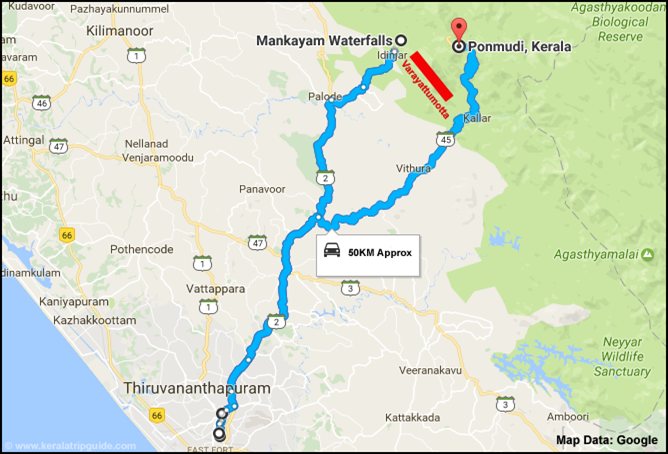
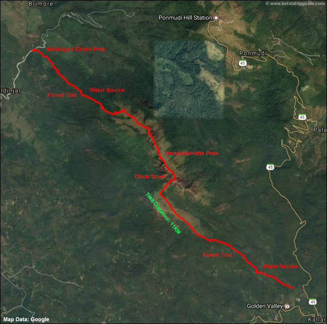
The following trek report is based on our trek from Mankayam to Kallar valley crossing the Varayattumotta ridge. The following map shows our trekking trail. There are no water sources on the main ridge and hence you must have adequate water with you before attempting this 10 hour trek.
Popular tourist spots around Varayattumotta peak include Ponmudi, Meenmutty waterfalls, Kallar river, Mankayam water falls and Braemore estate.
Varayattumotta Trek Report
Our trekking expedition was organized by a nature club in Trivandrum. We were a group of 8 people from different walks of life. We took the early morning (6:30AM) KSRTC bus from Trivandrum city to Braemore. Just before the Mankayam check post our bus stopped at a small hotel for breakfast.
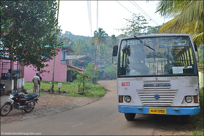
We reached the Mankayam check post around 8:15AM. Our trek leader had brought breakfast and lunch for the entire team. We had our breakfast in the dining hall behind the check post.
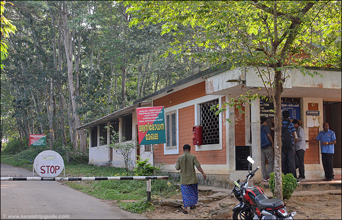
We started our trek from Mankayam check post around 8:45AM. The initial stretch itself was a difficult climb through a bamboo forest. Climbing immediately after a heavy breakfast wasn’t a bright idea. Luckily after the initial climb, the terrain alternated between steep climb and flat terrain. About an hour into our trek we came across a herd of elephants on the right side of our trail. Our guide was very careful and he helped us to bypass the herd without any incident.
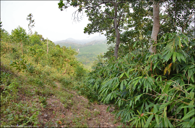
We reached an open area by 11AM after covering a distance of about 3.5km. From here we took a left turn towards another forest trail. By 11:15AM(4km) we reached the last water source on the ridge. Since we knew that there are no water sources for another 8 hours, we filled all our bottles and took a 10 minute break.
It took us another half an hour trek (4.75km) to reach the open base of the Varayattumotta mountain ridge. This location gave us a panoramic view of the Ponmudi mountain. We could see the Ponmudi road ahead of us and the tourists going to the top by car. Finally we could see the mighty Varayattumotta peak on our right side, hiding the rest of the peaks on the ridge.
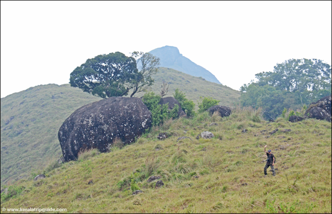
 We continued our climb and It took us while to reach the Varayattumotta peak. The final climb was steep and dangerous. We reached the top around 12:30pm covering a total distance of over 5km. Once you reach the top you realize that it is just the beginning of the trek! The top of the peak is a flat rock surface. The full Varayattumotta mountain ridge is visible only after crossing the second peak. In this ridge, climbing down a peak is much more difficult than climbing up. In some places rocks are extending towards the valley with a small part barely holding it to the mountain! Adventurous ones in our team took photos sitting on them.
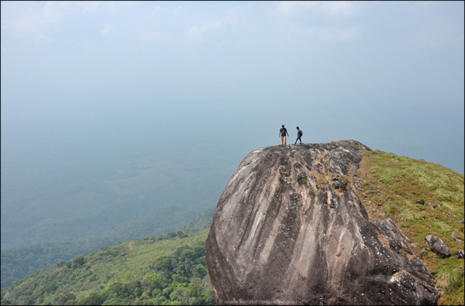
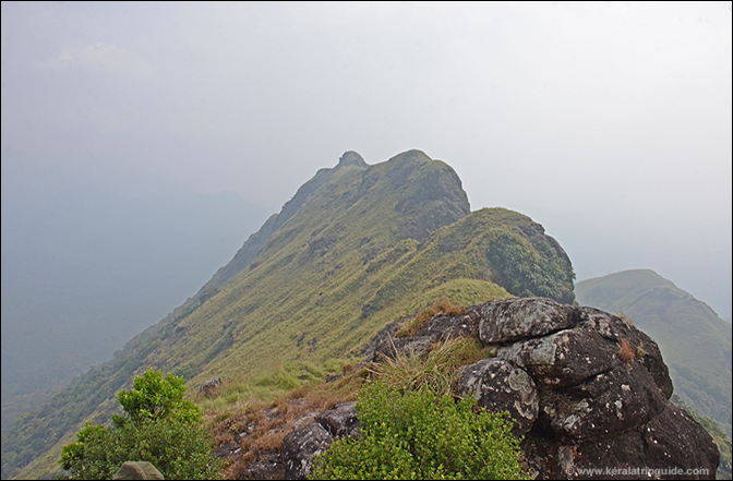
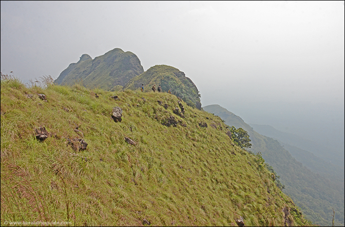
Nilgiri Tahr (Varayadu) in this range is very shy of humans. If you are lucky you may be able to get a glimpse of them running towards the valley as you climb to the top of the peaks. Today was not our lucky day.There are only a couple of trees on the mountain ridge. However on the western slope, there are a number of mini forests. There are also groups of tall palm trees on this slope. Some of the bushes along the trekking trail have long and sharp thorns on them.
We had our lunch on one of the peaks. The sun was relentless and I was now scared of running out of water. We were all very tired and this made climbing down the peaks much more dangerous. A small mistake could mean slipping down to the valley below.
We reached the last peak around 4PM. Just before the last peak there is a narrow path. This is a dangerous path surrounded by tall grass and sharp cliffs on both sides. I was very careful in crossing this stretch as a small mistake could be fatal. The trail to the Kallar valley is just before this last major peak. Most of us were too tired to climb the last peak.
The toughest part of Varayattumotta trek is the climb down from the last peak towards the Kallar valley. It is a dangerous 80 degree slope and the ground is very slippery with gravel and dust. You will have to crawl or slide down to minimize the risk of falling down.
After climbing down we took a left turn from the valley towards Kallar town. This is an open and relatively flat field for about a km or so. The next stretch was through a thick forest and we could see elephant droppings everywhere. It was getting dark, but the rapidly descending and slippery road slowed us down. Finally we reached a motorable dirt road connecting the Ponmudi-Kallar main road. Water was available at this junction. We relaxed here for a few minutes and then walked to the Kallar junction taking a shortcut along the way.
We reached Kallar junction around 7PM, just in time to catch the last bus from Ponmudi going to Vithura. From Vithura, I got a bus to Nedumangad and then to Trivandrum city. I reached home around 10PM.
Statistics – Varayattumotta Trek
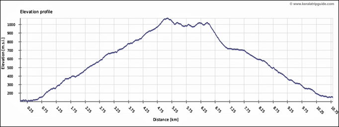
The total trek distance is around 11KM and it took us around 10 hours to cover it. The highest point we trekked to is at 1075 metres. Check out the following charts for a detailed look at Varayattumotta trek. Please note that the following charts show the GMT time and if you want to calculate the IST time, just add 5.5 hours.
Varayattumotta Trek Summary Report
Varayattumotta Trek Elevation Distance Profile
Varayattumotta Trek Tips
- Water is not available anywhere on the mountain range. So carry 3 bottles of water with you. Minimize the weight you carry.
- There are plenty of elephants on both sides of the Varayattumotta mountain range. So you need to be always aware of your surroundings. Follow the instructions of the local guide.
- Whenever you are climbing down, be very careful. A small mistake can be deadly. Crawling or sliding down is safer in many places.
- There are bushes with sharp thorns along the mountain range. I had one of them stuck in my thighs causing intense pain.
- Varayattumotta trek is a physically demanding trek. Attempt it only if you are in good shape. Also carry a small packet of glucose to fight hypoglycemia.
- There isn’t much shade along the mountain ridge. So carry a good hat.
Additional Resources
December 18, 2016 | Posted in Travel Reviews No Comments » | By Jayson


